Programme Parameters
Graduate / Intermediate
3 Days (4.5 Hrs)
Online (e-LMS)
• A basic understanding of the subject area and fundamental programming or scientific concepts.
• A laptop or desktop with a stable internet connection.
• Willingness to complete assignments and the capstone project.
About This Course
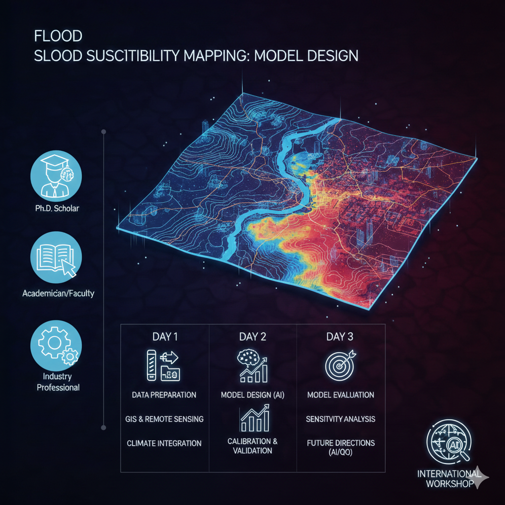
Flood Susceptibility Mapping teaches a high-impact application of geospatial machine learning: predicting where floods are likely and turning that into actionable maps. You assemble the driving factors — elevation and slope from digital elevation models, rainfall, land use, soil and drainage — then apply machine-learning models to weight them and produce a susceptibility map. The course covers data preparation in a GIS workflow, model training and validation against historical flood records, and how to communicate risk to planners. You finish able to build a defensible flood-susceptibility model for a region. A verified e-Certificate of competency and e-Marksheet from the Deep Science & Technology Consortium.
🎯 Program Aim
This course teaches flood susceptibility mapping — combining geospatial data, remote sensing and machine learning to model and map areas at risk of flooding.
📋 Course Objectives
1. Assemble elevation, rainfall, land-use and soil data.
2. Prepare geospatial layers in a GIS workflow.
3. Train ML models to weight flood-driving factors.
4. Validate maps against historical flood records.
5. Produce and communicate a susceptibility map.
👥 Who Should Enroll?
• GIS analysts and hydrologists
• Disaster-risk and urban-planning professionals
• Environmental data scientists
• Students specialising in geospatial modelling
🚀 Key Learning Outcomes
• The ability to build a flood-susceptibility model.
• A geospatial risk-mapping project.
• Skills bridging GIS and machine learning.
• A verified e-Certificate of competency and e-Marksheet from the Deep Science & Technology Consortium.
💎 What You'll Gain
Live & Recorded Sessions
Lifetime access to class recordingse-Certificate on Completion
Cryptographically verified credentialPost-Programme Support
Direct access to mentors & councilHands-On Experience
Notebooks, real-world code & datasetsCurriculum Outline
Day 1 – Geospatial Intelligence & Multi‑Source Data Fusion
Leverage advanced spatial stratigraphy with MCDA and high‑resolution DEMs • Integrate CMIP6 climate projections and satellite altimetry into susceptibility frameworks • Generate topographic morphometry layers through automated GIS pipelines
Day 2 – Algorithmic Architecture & Predictive Modeling
Compare traditional Frequency Ratio & Weight of Evidence with modern ML ensembles • Deploy Random Forest, SVM, and XGBoost for spatial classification • Optimize hyper‑parameters using Bayesian optimization techniques • Implement Neuro‑Fuzzy and CNN models for complex flood pattern recognition
Day 3 – Validation Rigor, Uncertainty, and Policy Integration
Interpret ROC curves and AUC for robust model assessment • Conduct sensitivity analysis using Jackknife and Sobol indices • Quantify uncertainty through error propagation and Monte Carlo simulation • Scale models for real‑time monitoring and Early Warning System integration
Technical Specifications
| Parameter | Requirement |
|---|---|
| Covered Tool / Platform | QGIS |
| Covered Tool / Platform | ArcGIS |
| Covered Tool / Platform | Python |
| Covered Tool / Platform | Scikit-learn |
| Covered Tool / Platform | TensorFlow |
| Covered Tool / Platform | Google Earth Engine |
| Covered Tool / Platform | Bayesian optimization |
Frequently Asked Questions
Scholar Feedback & Reviews
Based on 0 scholar submissions
Rating Breakdown
No verified reviews published yet. Be the first to share your academic experience.
Leave Scholar Feedback
Your rating will help prospective scholars. Ratings below 3 stars are routed privately to the faculty mentor for immediate response.