Programme Parameters
Advanced Postgrad
4 Weeks (40 Hrs)
Online (e-LMS)
• Prior working knowledge of the field and comfort with core tools and quantitative reasoning.
• A laptop or desktop with a stable internet connection.
• Willingness to complete assignments and the capstone project.
About This Course
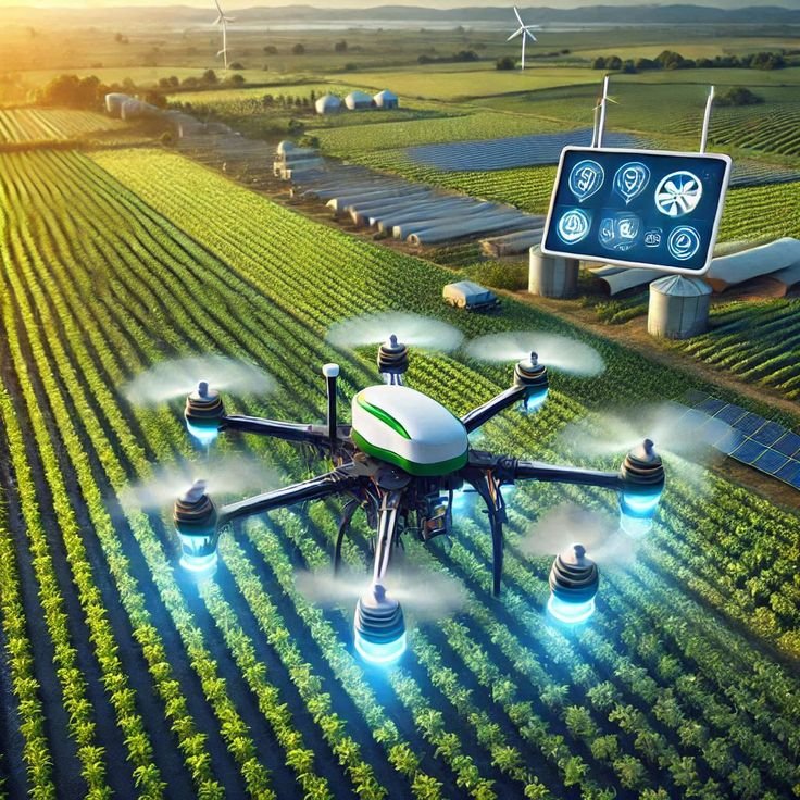
Agriculture Course: Precision Farming, AI, and Smart Agriculture is a mentor-based online program designed to help learners understand how modern technologies are reshaping agriculture. The course introduces participants to the use of artificial intelligence, machine learning, remote sensing, Internet of Things, drones, satellite imaging, smart irrigation systems, and data-driven decision-making for improving crop productivity, resource efficiency, and farm sustainability. Every participant receives a verified e-Certificate and e-Marksheet from the Deep Science & Technology Consortium.
🎯 Program Aim
Agriculture Course: Precision Farming, AI, and Smart Agriculture
is a mentor-based online program designed to help learners understand how modern technologies are reshaping agriculture. The course introduces participants to the use of artificial intelligence, machine learning, remote sensing, Internet of Things, drones, satellite imaging, smart irrigation systems, and data-driven decision-making for improving crop productivity, resource efficiency, and farm sustainability.
📋 Course Objectives
1. Translate Artificial Intelligence theory into practical, reproducible analysis.
2. Assemble a documented case study that evidences your applied capability.
👥 Who Should Enroll?
• Master's and senior undergraduate students specializing in Artificial Intelligence
• R&D engineers and working professionals applying Artificial Intelligence in industry
• Academics and educators building research or teaching capacity in Artificial Intelligence
🚀 Key Learning Outcomes
• Tangible, reproducible Artificial Intelligence work to show supervisors or employers.
• A verified e-Certificate of competency and e-Marksheet from the Deep Science & Technology Consortium.
💎 What You'll Gain
Live & Recorded Sessions
Lifetime access to class recordingse-Certificate on Completion
Cryptographically verified credentialPost-Programme Support
Direct access to mentors & councilHands-On Experience
Notebooks, real-world code & datasetsCurriculum Outline
Managing a Field That Is Not Uniform
• Within-field variability and management zones as the premise of precision agriculture
• GNSS guidance, controlled traffic and the 4R nutrient framework in practice
• Where precision spend pays back and where uniform management is still cheaper
Seeing the Crop and the Soil
• Multispectral and NDVI imagery from satellite and UAV, and what the index does and does not show
• Soil, weather and canopy IoT sensors, and the calibration they need to be trusted
• The resolution, revisit-time and cost trade-off behind every sensing choice
Turning Observations Into Maps
• Spatial data, yield maps and zone maps in QGIS and Google Earth Engine
• Interpolation between sample points and the error it quietly introduces
• Aligning layers from different sensors and dates into one decision surface
Prediction and Detection on the Farm
• Computer-vision crop and disease detection, and the labelled-data problem behind it
• Yield prediction and variable-rate application driven by the sensed layers
• Why a model trained in one region or season often fails in the next
A Workflow a Grower Could Use
• Building a crop-health or yield-estimation workflow from sensing to recommendation
• The economics and connectivity limits that decide smallholder adoption
• Communicating an uncertain recommendation to a grower without overstating it
Technical Specifications
| Parameter | Requirement |
|---|---|
| Covered Tool / Platform | Precision Farming |
| Covered Tool / Platform | Smart Agriculture |
| Covered Tool / Platform | Artificial Intelligence |
| Covered Tool / Platform | Machine Learning |
| Covered Tool / Platform | IoT Sensors |
| Covered Tool / Platform | Remote Sensing |
| Covered Tool / Platform | Drone Imaging |
| Covered Tool / Platform | Satellite Imaging |
| Covered Tool / Platform | Crop Monitoring |
| Covered Tool / Platform | Yield Prediction |
| Covered Tool / Platform | Smart Irrigation |
| Covered Tool / Platform | Climate-Smart Farming |
Frequently Asked Questions
Scholar Feedback & Reviews
Based on 0 scholar submissions
Rating Breakdown
No verified reviews published yet. Be the first to share your academic experience.
Leave Scholar Feedback
Your rating will help prospective scholars. Ratings below 3 stars are routed privately to the faculty mentor for immediate response.