Programme Parameters
Graduate / Intermediate
4 Weeks (40 Hrs)
Online (e-LMS)
• A basic understanding of the subject area and fundamental programming or scientific concepts.
• A laptop or desktop with a stable internet connection.
• Willingness to complete assignments and the capstone project.
About This Course
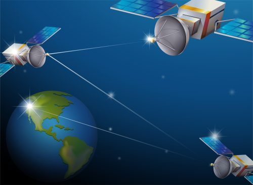
Satellite Technology for Climate Monitoring and Disaster Management explains how eyes in space help us watch the planet and respond to crises. You learn the satellite systems and sensors used for Earth observation, how they monitor climate variables and change, and how satellite data supports every phase of disaster management — early warning, response and recovery for floods, fires, storms and more. The course connects the technology to real climate and disaster applications. You finish with a grounded understanding of satellite-based climate and disaster monitoring. A verified e-Certificate of competency and e-Marksheet from the Deep Science & Technology Consortium.
🎯 Program Aim
This course covers satellite technology for climate monitoring and disaster management — using Earth-observation satellites to track climate and respond to natural disasters.
📋 Course Objectives
1. Explain satellite systems and Earth-observation sensors.
2. Monitor climate variables and change.
3. Support disaster early warning.
4. Aid response and recovery from data.
5. Apply satellites to real climate and disaster cases.
👥 Who Should Enroll?
• Climate and disaster-management professionals
• Remote-sensing and GIS analysts
• Environmental and emergency staff
• Students of earth observation
🚀 Key Learning Outcomes
• An understanding of satellite climate/disaster monitoring.
• An Earth-observation perspective.
• A foundation in geospatial climate work.
• A verified e-Certificate of competency and e-Marksheet from the Deep Science & Technology Consortium.
💎 What You'll Gain
Live & Recorded Sessions
Lifetime access to class recordingse-Certificate on Completion
Cryptographically verified credentialPost-Programme Support
Direct access to mentors & councilHands-On Experience
Notebooks, real-world code & datasetsCurriculum Outline
Foundations of Satellite Technology For Climate Monitoring And Disaster Response and Core Biological Principles
Analyze the principles of satellite remote sensing and its applications in climate monitoring and disaster response • Develop a comprehensive understanding of the biological principles underlying satellite-based climate monitoring and disaster response • Evaluate the current state of satellite technology in climate monitoring and disaster response, including its limitations and potential
Laboratory Techniques, Protocols, and Data Collection
Configure laboratory equipment and software for satellite data collection and analysis • Implement standardized protocols for data collection, quality control, and quality assurance in satellite-based climate monitoring and disaster response • Design and develop data management plans for satellite-based climate monitoring and disaster response research projects
Bioinformatics Tools and Computational Analysis
Apply bioinformatics tools and computational methods to analyze satellite data for climate monitoring and disaster response • Develop and implement algorithms for satellite data processing, analysis, and visualization • Evaluate the performance of bioinformatics tools and computational methods in satellite-based climate monitoring and disaster response research
Research Methodology and Experimental Design
Design and develop research methodologies for satellite-based climate monitoring and disaster response research projects • Implement experimental designs for testing hypotheses and evaluating research questions in satellite-based climate monitoring and disaster response • Analyze and interpret research results using statistical and computational methods
Advanced Satellite Technology For Climate Monitoring And Disaster Response Applications and Translational Research
Develop and apply advanced satellite technologies for climate monitoring and disaster response, including machine learning and artificial intelligence • Evaluate the potential of satellite technology for translational research in climate monitoring and disaster response • Design and implement satellite-based systems for climate monitoring and disaster response applications
Regulatory Compliance, Bioethics, and Safety Standards
Evaluate regulatory compliance requirements for satellite-based climate monitoring and disaster response research • Develop and implement bioethics and safety standards for satellite-based climate monitoring and disaster response research • Analyze and mitigate potential risks and liabilities associated with satellite-based climate monitoring and disaster response research
Industry Applications, Career Pathways, and Case Studies
Analyze industry applications of satellite technology for climate monitoring and disaster response • Develop career pathways and professional development plans for satellite-based climate monitoring and disaster response professionals • Evaluate case studies of successful satellite-based climate monitoring and disaster response projects and programs
Technical Specifications
| Parameter | Requirement |
|---|---|
| Covered Tool / Platform | Python |
| Covered Tool / Platform | TensorFlow |
| Covered Tool / Platform | ArcGIS |
| Covered Tool / Platform | QGIS |
Frequently Asked Questions
Scholar Feedback & Reviews
Based on 0 scholar submissions
Rating Breakdown
No verified reviews published yet. Be the first to share your academic experience.
Leave Scholar Feedback
Your rating will help prospective scholars. Ratings below 3 stars are routed privately to the faculty mentor for immediate response.